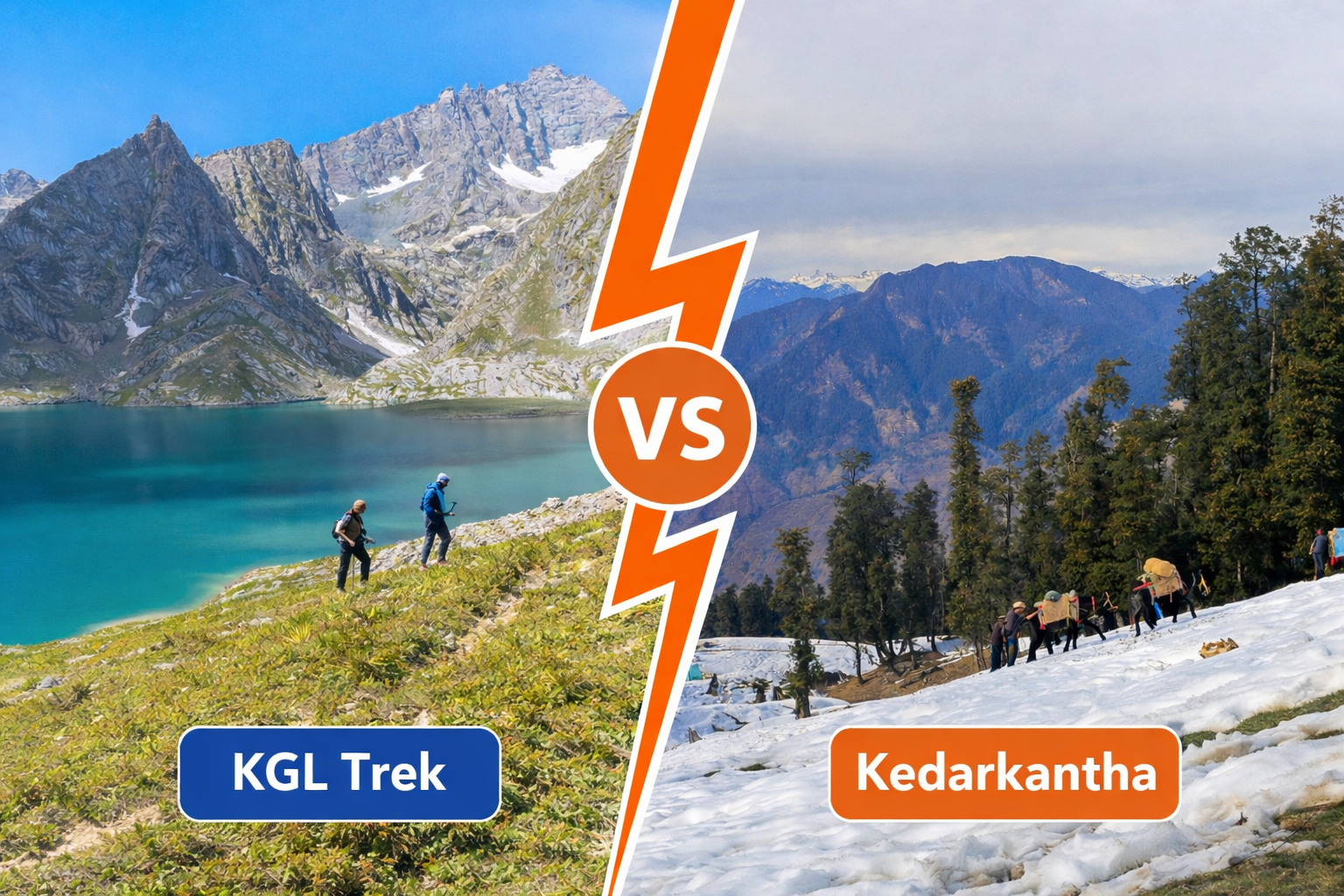
Mountain Peaks Visible from Shitkadi Basecamp include Kolahoi Peak, Machoi Peak, Sirbal Peak, Amarnath Peak, and the Thajiwas and Machoi glaciers, making this campsite one of the most informative natural viewpoints on the Kashmir Great Lakes Trek. If you stand at Shitkadi and look up, you are already reading tomorrow’s terrain.
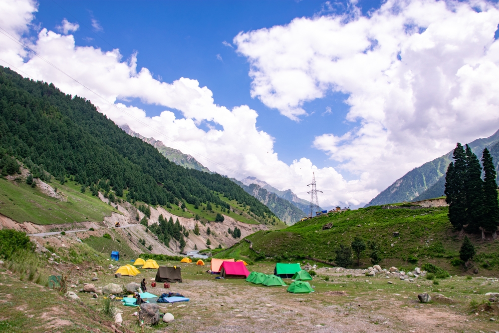
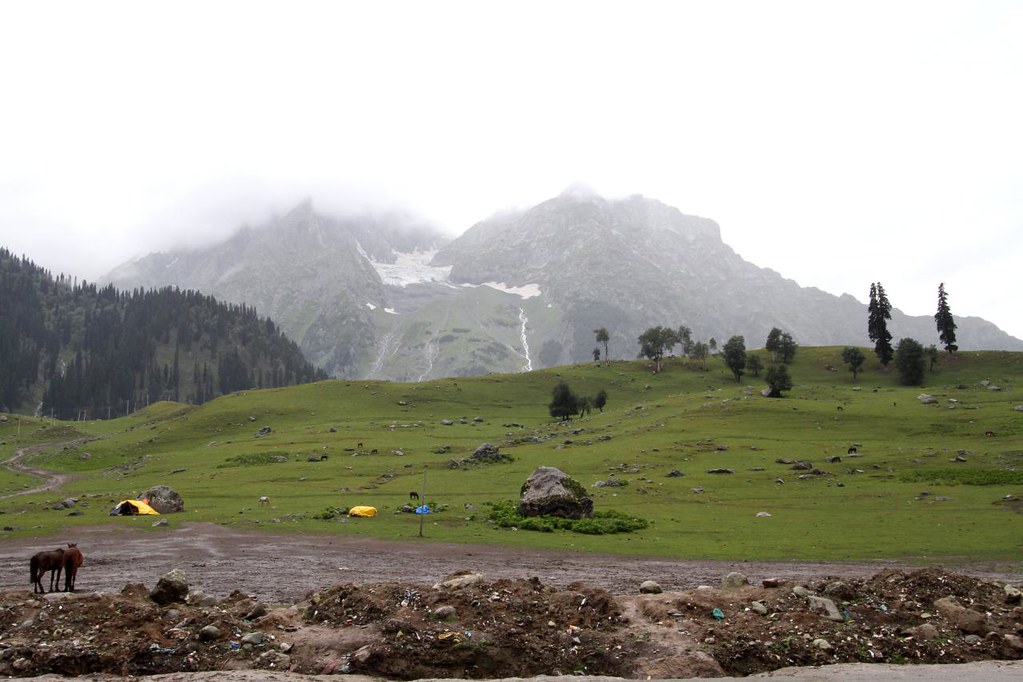
Shitkadi Basecamp sits at an altitude of roughly 2,400 to 2,600 metres above sea level. It lies about 3 km from Sonamarg and around 80 to 90 km from Srinagar by road. This is the official Day 1 basecamp of the KGL Trek, and it offers one of the clearest mountain previews of the entire route.
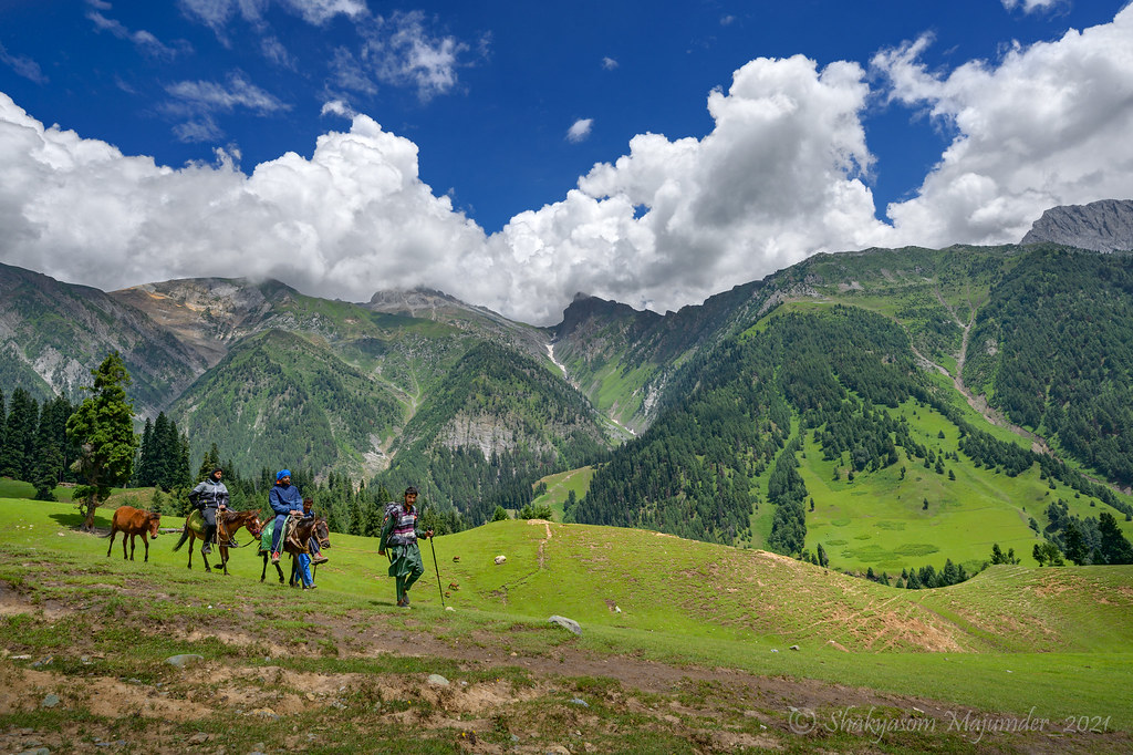
Unlike higher camps, you do not need to hike to a ridge to see the peaks here. The meadow opens directly into a glacier bowl framed by major Himalayan summits. That is why Shitkadi is not just a sleeping point. It is a natural orientation zone for trekkers.
Major Mountain Peaks Visible from Shitkadi
These are the real, named peaks and glaciers visible from the basecamp on clear days.
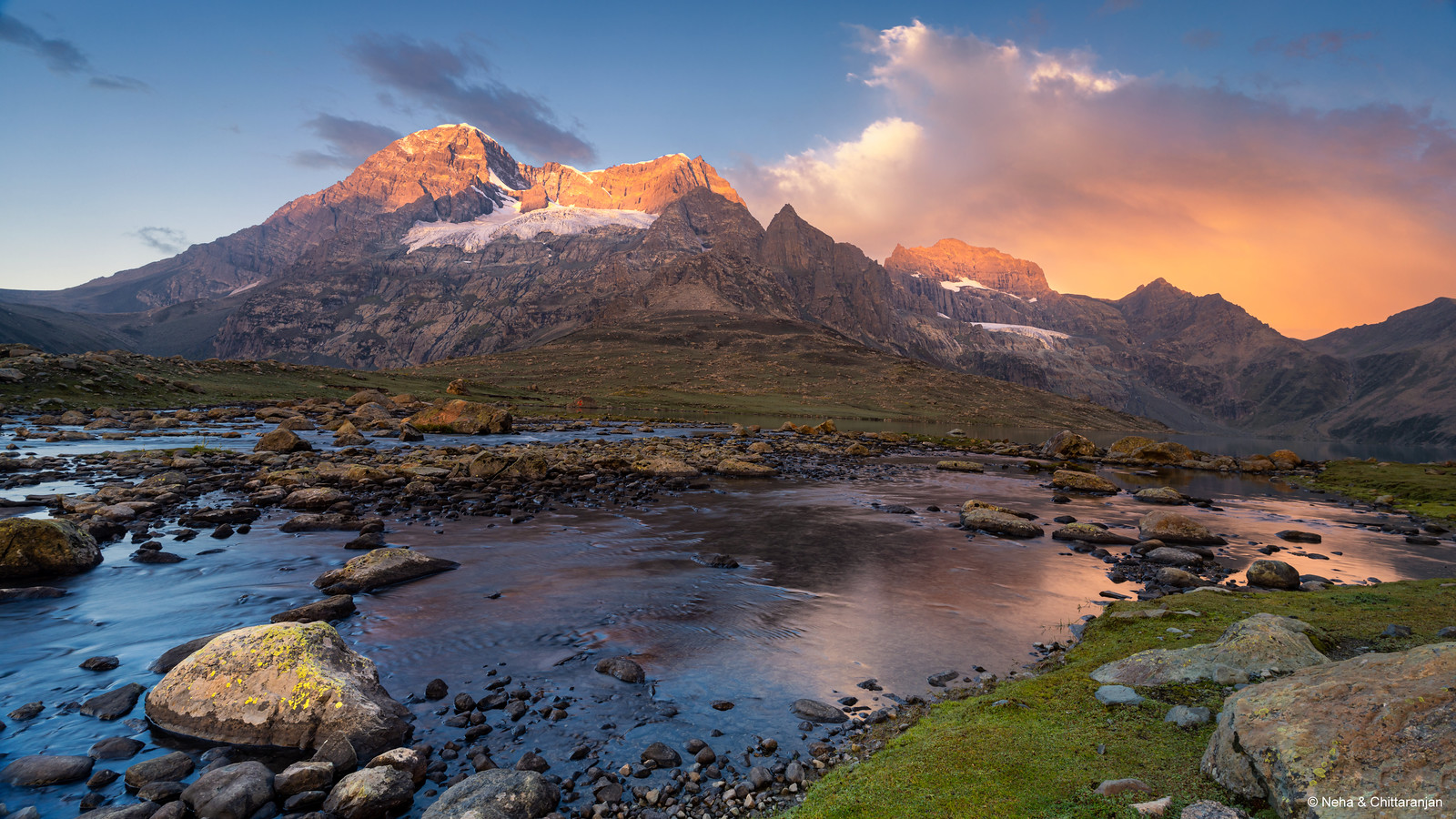
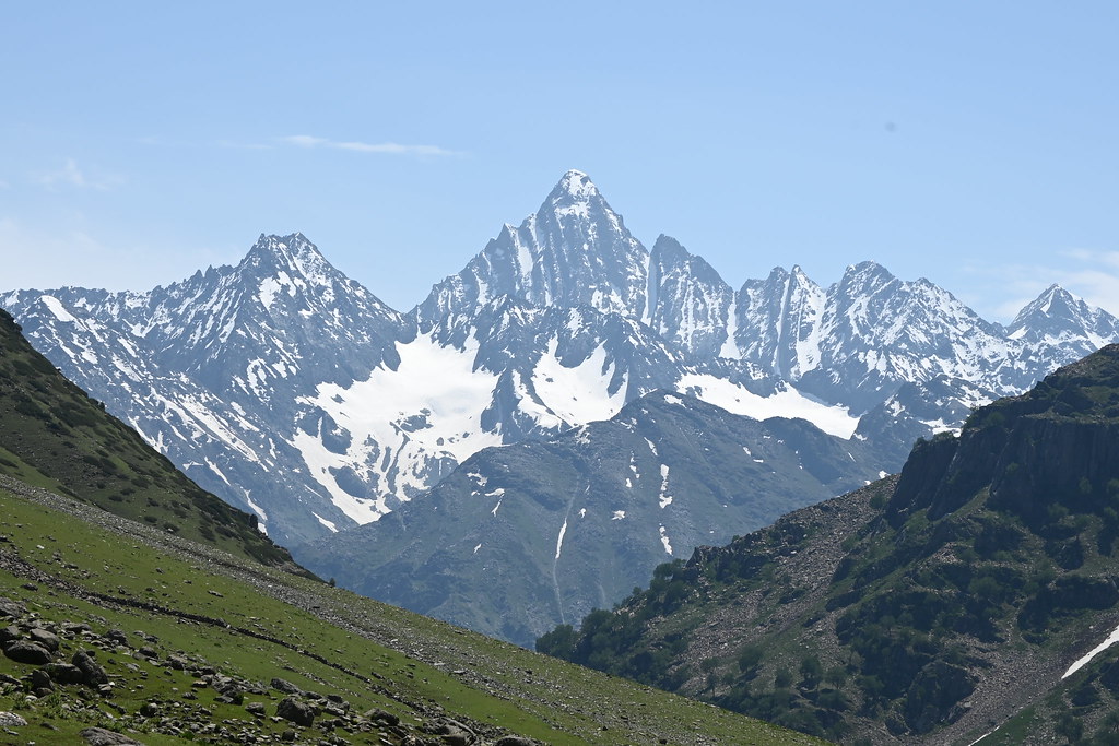
Kolahoi Peak – 5,425 m (Centre): The tallest and most dominant summit in view. It has a sharp, pyramid-like shape and holds permanent snow. It forms the visual centre of the skyline.
Machoi Peak – ~5,458 m Far Right (North-West): A rugged peak near Machoi Glacier. It is recognisable by its dark rock face and vertical ice gullies cutting through its slope.
Sirbal Peak – ~5,000 m (Far Right (North-West): A broad, softer-looking summit with long ridges. It appears less sharp than Kolahoi but spans wider across the horizon.
Amarnath Peak – 5,186 m (Far Left (North-East): A massive, distant peak in the Amarnath region. It often sits under thin cloud bands and looks heavier in profile.
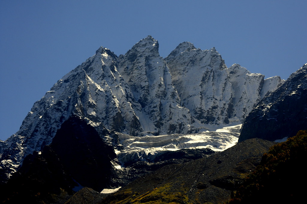
Thajiwas Glacier – base ~3,000 m (Centre-Left): The most prominent ice feature from Shitkadi. It looks like a frozen river flowing straight down the mountain.
Machoi Glacier (Centre-Right): A rougher glacier with visible crevasses and layered ice. It sits below Machoi Peak and reflects strong sunlight.
These are not occasional sightings. On most clear days, all of them are visible from camp.
How to Visually Identify Each Peak
When you first scan the horizon from Shitkadi, the peaks can blur into one long white wall. But each summit carries a distinct signature.
Kolahoi Peak dominates the centre with a sharp pyramid summit. If you see only one peak clearly, it is usually this one. Its upper snowfield runs smooth and unbroken, unlike the fractured ice on nearby slopes. At 5,425 metres, it stands tall and clean against the sky, which is why most trekkers mistake it as the only major peak in view.
Machoi Peak sits to the right, and it looks completely different from Kolahoi. Where Kolahoi appears smooth and geometric, Machoi feels rough and broken. Look for a dark rock face slashed by steep ice gullies. These vertical channels stay visible even in flat afternoon light. At roughly 5,458 metres, Machoi is technically taller than Kolahoi, but it appears smaller because it sits farther back in the range.
Sirbal Peak spreads wider across the skyline than the others. It lacks sharp drama, but it fills more horizontal space. Its ridges feel long and calm, with softer snow lines and fewer deep shadows. Think of Sirbal as the quiet elder among sharper, more aggressive neighbours.
Amarnath Peak hides in the distance, usually on the far left of your view. It looks heavier than the others, with a flatter crown and bulkier profile. Clouds tend to settle on Amarnath first. It is common to see Amarnath capped in cloud while Kolahoi remains fully clear.
Thajiwas Glacier sits straight ahead, flowing like a frozen river down into the bowl. You can often see two to three icefalls stepping down its face. In strong light, it reflects silver and pale blue tones that shift through the day.
Machoi Glacier lies below Machoi Peak, narrower and rougher than Thajiwas. It shows layered ice bands and deeper crevasse shadows. In the afternoon, its texture becomes more visible than its brightness.
Best Time of Day to View the Peaks
The mountains around Shitkadi change personality through the day. Timing shapes what you see more than most weather apps.
Early morning, between 5:30 and 7:00 am, offers the cleanest definition. Peak outlines stay sharp, cloud movement stays minimal, and glacier textures stand out clearly. This is when Kolahoi looks tallest and Thajiwas Glacier looks widest.
Late morning, from 9:00 to 11:00 am, brings bright snow reflection. This is the best window to spot Amarnath Peak clearly before clouds start drifting in from the left side of the valley.
Evenings, from 5:00 to 7:30 pm, soften the scene. Light strikes the peaks at an angle, creating long shadows across Kolahoi and Sirbal. The glaciers lose brightness but gain depth and texture.
If you can only choose one slot, choose early morning. It shows the mountains at their most readable.
Month-by-Month Peak Visibility from Shitkadi
July
Maximum snow on peaks and glaciers. Thajiwas and Machoi glaciers look dramatic. Clouds often build by noon.
August
Frequent cloud cover. Lower glacier sections remain visible. Upper peaks often hide after late morning.
September
Clearest skies. Best long-range visibility. Less snow on lower slopes. Best month for identifying all peaks clearly.
If your goal is dramatic snow visuals, July works best. If your goal is clarity and identification, September is unmatched.
How Shitkadi Views Compare to Other KGL Viewpoints
From Sonamarg town, the elevation is lower and the viewing angle is flatter. You see parts of Thajiwas Glacier, but major peaks feel farther away and less defined.
At Shitkadi Basecamp, you get a direct glacier bowl view. Peaks rise straight from the meadow. This is the best low-altitude spot to identify Kolahoi, Thajiwas, and Machoi clearly.
From Nichnai Pass, the next day, the entire peak set changes. You move higher, and the Harmukh range begins to dominate instead of Kolahoi. The perspective becomes grander but less instructional.
At Vishansar Lake, the mountains reflect in water and feel more cinematic. But they are different peaks and offer no direct learning link to Shitkadi’s terrain.
Shitkadi is the only camp where glaciers, peaks, and meadow form one continuous visual frame.
Technical Trek Data Linked to These Peaks
- Shitkadi to Nichnai Pass distance: 11–12 km
- Altitude gain: ~1,100 m
- Time required: 6–8 hours
- Terrain preview: Slopes below Machoi Glacier and Kolahoi Peak mirror the Day 2 climb.
When you look at Kolahoi and Thajiwas from camp, you are mentally mapping your route without realising it.
How to Read Weather from Shitkadi Mountain Views
The mountains around Shitkadi act like a live forecast board.
If Kolahoi’s summit stays clear at dawn, the day usually remains stable. If a cloud cap forms on Amarnath Peak, expect rain or snow later in the afternoon. When fog fills the valley below Thajiwas Glacier, it usually stays local and clears by midday. If you see lenticular clouds forming over the glaciers, wind speed will likely rise within two to three hours.
These signs often prove more accurate than phone forecasts in this valley. Learn more about Kashmir Great Lakes Trek weather patterns.
Photography Guidance Specific to Shitkadi
Shitkadi rewards simple, location-aware photography rather than heavy gear.
A 24–70 mm lens captures the full glacier panorama well. A 70–200 mm lens works best for isolating Kolahoi Peak or Machoi’s ice gullies. The western edge of the meadow offers the widest glacier view, while a slight rise near the tents gives better layered depth.
Morning light hits the peaks front-on, preserving texture. Evening light creates side shadows that enhance relief. A polarizing filter reduces glare on Thajiwas Glacier, especially after 9:00 am. Avoid shooting at noon, when snow loses contrast and detail.
For more detailed tips, check our guide on Kashmir Great Lakes Trek photography spots.
Key Takeaways
- Shitkadi Basecamp sits at ~2,400–2,600 m near Sonamarg.
- Visible peaks include Kolahoi, Machoi, Sirbal, and Amarnath.
- Thajiwas Glacier is the most prominent feature in front of camp.
- Facing north gives a left-to-right peak sequence for easy identification.
- July offers the most snow; September offers the clearest skies.
- The view previews the climb to Nichnai Pass on Day 2.
If you can correctly identify Kolahoi, Thajiwas, and Machoi from Shitkadi, you already understand the terrain logic of the Kashmir Great Lakes Trek. Most trekkers walk past that lesson without ever noticing it.